by Carolyn Bernhardt
March 19, 2024
Traditional field surveys can drain a team’s time and effort when it comes to surveilling the spread of invasive plants. So, scientists are taking to the skies, using satellite and drone images to identify invasive species. They take satellite and drone-based photos, and rely on publicly available images taken by the government, to understand where an invasive species might be growing. Then, they feed the pictures to computer systems that analyze them to predict where invasive species might spread in the future, creating reliable predictive maps that help managers detect invasive species early on.
“We give the computer a large dataset where we know the answers and then allow a computer algorithm time to learn patterns and relationships in the data by trial-and-error,” says Ryan Briscoe Runquist, PhD, senior research associate in David Moeller's lab in the University of Minnesota Plant and Microbial Biology Department. “Some patterns may be similar to those we can see with our traditional methods and statistics, but others may be higher-level relationships that are harder for us to pull out and may not be intuitive.” But because the scientists are letting the computer suss out the relationships, they must give it a lot of data to start. “We work as hard as possible to make sure that the data are not biased or that we have some understanding of possible biases in the dataset so that we don’t incorporate those into our models.”
In previous research, Runquist and Moeller worked on developing predictive model maps for 9 invasive weed species on the state's Noxious Weed List. These maps were intended not only to simplify early detection efforts but also enhance eradication strategies.
“With climate change, many traditional modeling approaches predict that [certain invasive species] may become less problematic with time,” says Runquist. “However, we were worried that some of the assumptions baked into those models might lead researchers and land managers to underpredict species' current and future invasion risks.”
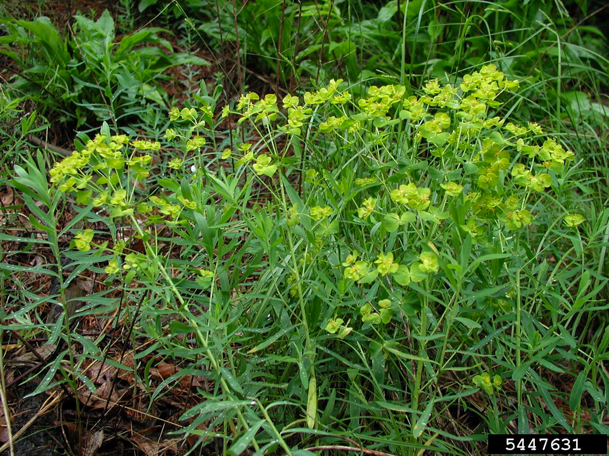
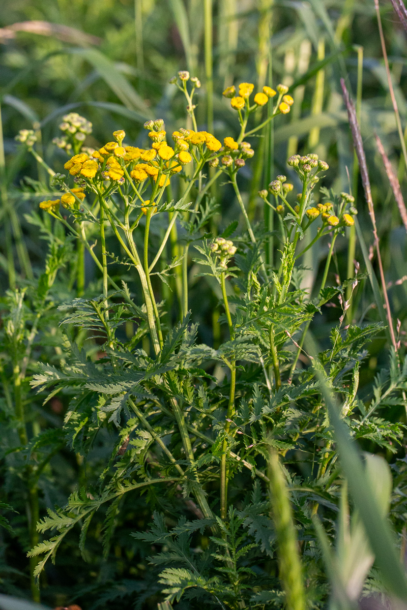
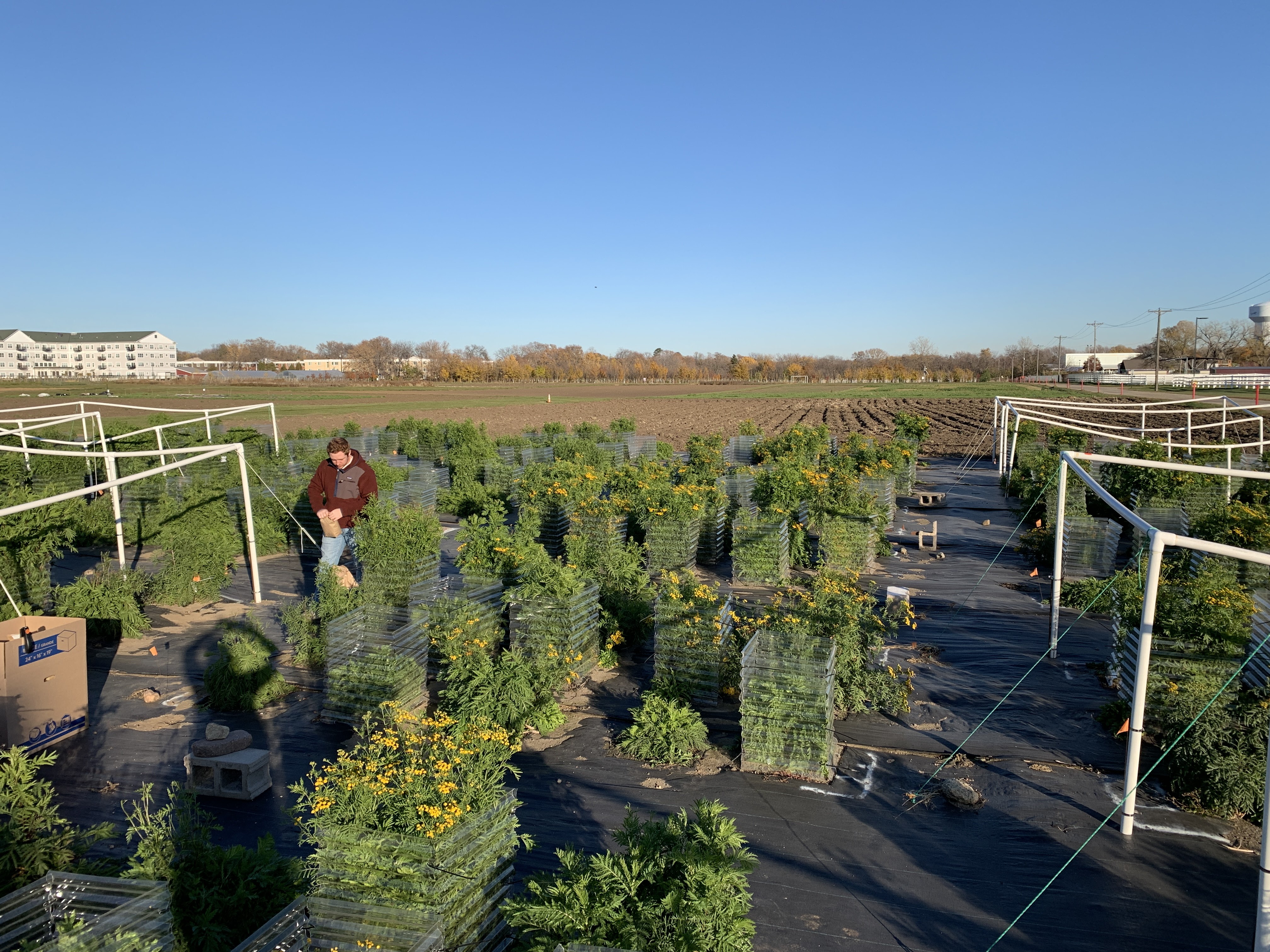
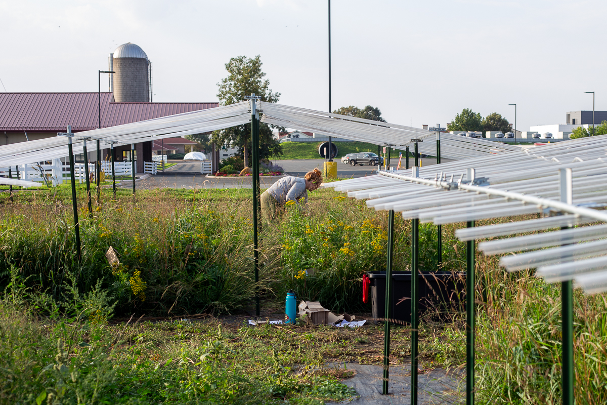
Given this experience, the team decided to target two key invasive species, common tansy (Tanacetum vulgare) and leafy spurge (Euphorbia esula).
“Both species are highly problematic rangeland invasive plants that are common in the northern tier of the US,” Runquist says. “Our work with leafy spurge focuses primarily on using available satellite imagery and new deep learning modeling to help fill in occurrence records and deal with the biases in collection data that can influence distribution models. Our work on common tansy focuses more on how the species may adapt to warmer and drier habitats and how we can incorporate that information into distribution models to generate better predictions.”
Target 1: Leafy spurge
Researchers used cutting-edge deep-learning computer models to study leafy spurge. They took less frequent high-resolution satellite images and more frequent low-resolution satellite images of the plant, and used advanced computer modeling to analyze them.
Ultimately, both approaches were just over 96% accurate. The researchers noticed that the models were particularly effective during early and mid-season phenological periods, capturing critical stages in plant development. These findings suggest that combining deep learning models with satellite images over time can accurately identify and monitor invasive plant species. The method provides valuable insights for future remote sensing-based management efforts, especially in large, remote, and data-sparse areas. The researchers also saw that the climate conditions in which leafy spurge could survive has expanded.
“Our leafy spurge work is allowing us to learn more about using remote-sensing data and deep learning for species detection,” says Runquist. “Eventually, we should be able to develop models to identify even more species with distinct signatures in satellite imagery.”
In another investigation, the team used large-scale field experiments and genomic analyses to study leafy spurge in Minnesota over 130 years. This research found that as leafy spurge spread to new areas, it retained much of its genetic diversity.
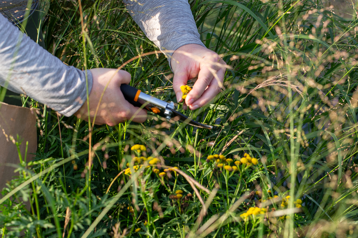
Target 2: Common tansy
Common tansy is an invasive perennial that causes significant concerns in the Upper Midwest and northeastern states because it disrupts native plant communities. In Minnesota, the abundance of common tansy has notably surged in recent years, particularly in the cooler and wetter northeastern region, which is home to more dense common tansy populations. While current species distribution models predict that common tansy may not invade western and southern Minnesota's warmer and drier regions, and populations might recede northward due to climate change, real-world observations by land managers indicate a contrary trend—a noticeable expansion of common tansy has emerged westward and southward.
The researchers were especially curious whether adaptation played a role in the increased abundance and spread of common tansy. By asking specific questions about the traits of common tansy and the spatial scale of local adaptation, the research team sought to uncover how these plants differ across the state and how that can influence management decisions. Their findings provide valuable insights that may help manage these invasive species and be relevant for dealing with other invasive plants in the future.
“We are learning about how common tansy has adapted during invasive spread, which may inform how other invasive species can adapt as well,” says Runquist. We are also developing methods to incorporate information on adaptation into predictive distribution models to allow for more information in strategic decision-making processes.”
Predictive power for land managers
The researchers have improved predictions about the capacity for range expansion of leafy spurge and common tansy. Both species have demonstrated trait evolution as the plants move across the state. This has the potential to impact further invasion and may influence the response to climate change. The newer distribution models that are in progress could help land managers determine how best to allocate limited resources.
“We are developing a new integrative framework that can incorporate many data sources and be applied across diverse systems,” says Runquist. “The methods can be applied to other species. And we are developing new and innovative methods for distribution modeling that we and other researchers can build upon to advance modeling strategies. At the same time, land managers can use our models and methods today to make more reliable predictions for decision-making.”
“The biggest strength of our work is how interdisciplinary it is,” Runquist says. “We draw on many different scientific traditions from ecology, evolution, genomics, invasion biology, weed sciences, remote sensing, and machine learning.” The team also integrates information from genomic to landscape-level patterns and processes, allowing them to research and develop integrative and innovative solutions to the pressing problems posed by invasive plants. “In so doing, we have developed several models and modeling techniques that provide a better understanding of the invasion biology of the species that we study, as well as developed insights that can be applied to all invasive species.”
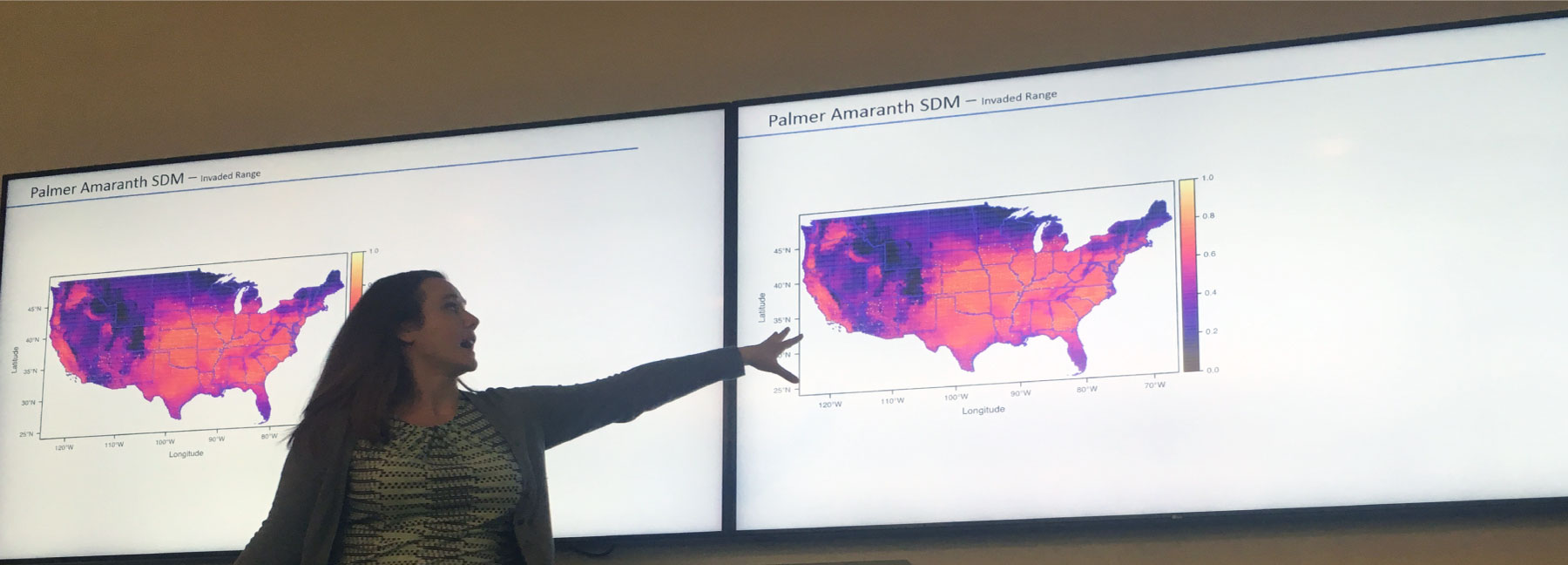
Runquist says feedback from land managers using these new methods has been positive so far. In particular, applying this approach to Palmer amaranth, an invasive species affecting agricultural crops, has produced fruitful discussions about leveraging time-series data to better understand invasion risk and the limits of traditional models.
“This approach also poses some challenges because it is often like putting together a jigsaw puzzle with very few instructions,” says Runquist. “It requires flexibility, adaptability, and strategic problem-solving that requires a lot of conversations with leaders in many different disciplines. Going forward, we will continue strengthening our relationships across disciplines and further refine and build upon the research we have already started.”
The Minnesota Invasive Terrestrial Plants and Pests Center is supported by the Environment and Natural Resources Trust Fund as recommended by the Legislative-Citizen Commission for Minnesota Resources.
Stay connected by signing up for the MITPPC newsletter. Follow us on LinkedIn and Facebook.
You may also like...
- Improved detection and management of leafy spurge and common tansy, research project
- Incorporating adaptation into forecasts of range shifts with climate change, research project
- Climate change and range expansion of invasive plants, research project
- Leafy spurge information, MN Department of Natural Resources
- Common tansy information, MN Department of Natural Resources